Overview of Onahama Port (English)
Overview of Onahama Port
Location (click on the map to see enlarged map)
Position of Onahama Port within the world 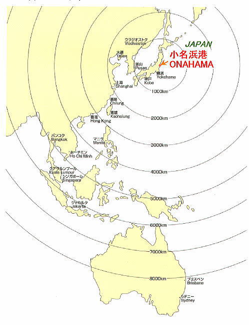 | Map of Fukushima Prefecture  (Source: Pamphlet issued by the Utilization and Promotion Council for Onahama Port) (Source: Pamphlet issued by the Utilization and Promotion Council for Onahama Port) | Distances between Onahama Port and major Japanese cities 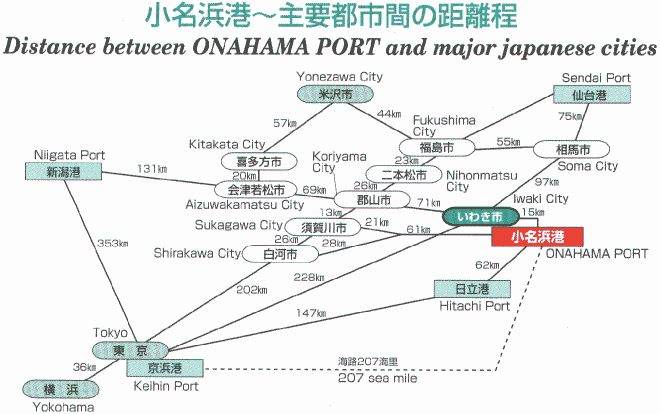 (Source: Pamphlet issued by the Utilization and Promotion Council for Onahama Port) (Source: Pamphlet issued by the Utilization and Promotion Council for Onahama Port) |
Overview
Onahama Port is located on the coast of Iwaki-shi in Fukushima Prefecture, facing the Pacific Ocean. The foundations of the port were laid in 1747 when the magistrate's office of the Shogunate was placed here for the purpose of shipping out rice payments collected from each of the feudal domains of Iwaki to Edo. From the Meiji Era on, accompanying the increasing demand for coal, the port served as a base for shipping coal from the Hitachinaka-Bandai area coal mines to the Tokyo and Yokohama regions, and greatly contributed to the industrial development of Japan.
Since completion of the first wharf, a 5,000 ton quay, in 1938, the port developed much as planned, although there were a few suspensions due to the war. In 1956, it became an open port based on the Customs Law, and in 1964, when the Joban-Koriyama region was designated as a new industrial city and coastal industrial regions began forming in and around Onahama, Onahama Port expanded and developed into an international trading port. In September 1998, a foreign container service was begun, which further enhanced the port's serviceability. Going forward, Onahama Port intends to strengthen its domestic and foreign container capabilities as a distribution base serving the South Tohoku region to become an even more comprehensive distribution port. At the same time, it aims to transform into a new 21st century port that many people can enjoy, by re-developing piers 1 and 2 to create a tourist produce center and a marine science museum, and making other improvements to its original facilities.
Geographical features
| Position | 140C 55' 29'', east latitude, 36C 56' 6'', north longitude |
Overview of Ohtsurugi foreign trade container terminal facility (as of March 31, 2000)
| ●Overview of foreign trade container terminal facility | ||||||||||||||||||
|
