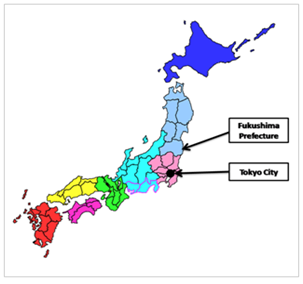
JET in Fukushima: Location
      |
JET in Fukushima
Location and Geography
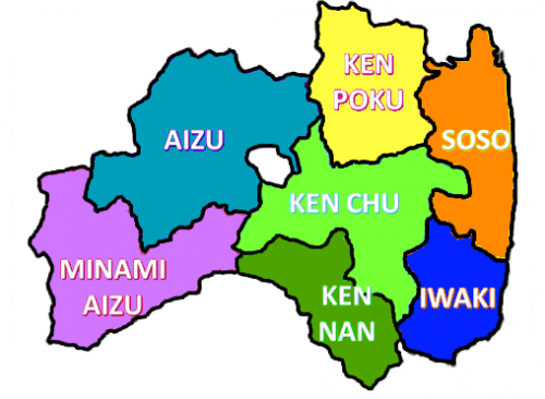
Geographical Features Fukushima Prefecture was established in 1876, through the amalgamation of three earlier prefectures. At present, it is composed of 13 main cities, including Fukushima City(the capital), Koriyama, Iwaki and Aizu-Wakamatsu, as well as 46 townships and villages. Covering an area of 13,783 square kilometers, Fukushima Prefecture stretches 166 kilometers from east to west and 133 kilometers from north to south; this expanse makes it Japan's third largest prefecture. With a shape that resembles the country of Australia,the prefecture is divided from east to west into the three regions of Hama-dori (coastal region),Naka-dori (inland region) and Aizu by the Ou and Abukuma mountain ranges,which run from north to south. Each of the three areas possess a distinct climate, economy and culture.
Contact: kokusai@pref.fukushima.lg.jp |