See here for the latest information
Transition and current status of air dose rates in Fukushima Prefecture
"~Fukushima Today~Steps for Reconstruction and Revitalization in Fukushima Prefecture"
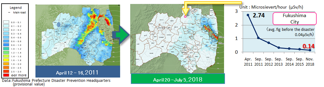
The air radiation dose rates within the prefecture have significantly decreased since April, 2011.
- Changes in radiation doses
- Comparison with global data
- Fukushima Prefecture's radioactivity measurement map
Changes in radiation doses
Air radiation dose rate map for the entire Fukushima Prefecture, based on Fukushima Prefecture's environmental radiation monitoring mesh survey results
Influence of radiation in everyday life
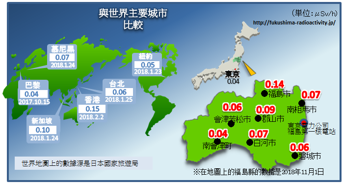
Comparison with global data
|
|
Japanese major cities (unit μSv/h)
The city name (atomic energy regulation agency data) Overseas major cities (unit μSv/h)
The city name (data:Japan National Tourism Organization) |
Fukushima Prefecture's radioactivity measurement map
 | The Fukushima Prefecture's radioactivity measurement map is updated with every new measurement. (The data obtained by monitoring posts and real-time dosimeters are updated daily.) |

Instrument and method for measuring radiation
Monitoring post
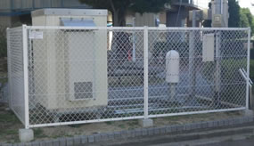 | In total, 629 monitoring posts have been placed at public facilities in the prefecture to monitor changes in air dose rates. |
Real-time dosimeter
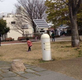 | Mainly to monitor the radiation dose rates in areas frequented by children, 2,996 units are installed in the prefecture's schools, childcare centers, parks, etc. |
Mobile monitoring
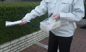 | Places where many people gather, such as tourist spots and meeting places, are measured with a survey meter once a year (twice a year for tourist spots). |
Survey from vehicle
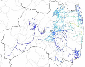 | A car equipped with a radiation meter with GPS functions is used to measure the radiation dose rate in the air over a specified driving route. Some route buses are also equipped with such units to regularly conduct measurements. |
Radionuclide analysis
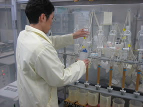 | The amounts of radioactive substances contained in dust, particles (floating dust), falling matters, soil, etc. are being surveyed. |
このページに関連する情報
![]()
PDF形式のファイルをご覧いただく場合には、Adobe社が提供するAdobe Readerが必要です。
Adobe Readerをお持ちでない方は、バナーのリンク先からダウンロードしてください。(無料)